Dettagli Percorso
Cumbentu - punto di partenza G 641
Nuoro,
Marghine,
Bolotana,
Area G,
Sardegna,
Europa,
Europa
Cumbentu - punto di partenza G 641
Località BADU - Punto di partenza G 640, 642
Nuoro,
Bolotana,
Marghine,
Area G,
Sardegna,
Europa,
Europa
Località BADU - Punto di partenza G 640, 642
Nuoro,
Marghine,
Bolotana,
Area G,
Sardegna,
Europa,
Europa
Località Nieddio
Nuoro,
Sardegna,
Marghine,
Bolotana,
Area G,
Europa
Cantaru de Murrone
Oruvere - Fine sentiero 643B
Europa,
Nuoro,
Marghine,
Bolotana,
Area G,
Sardegna
Oruvere - Fine sentiero 643B
Tolovò - punto di partenza sentiero G-640A
Nuoro,
Marghine,
Bolotana,
Area G,
Sardegna,
Europa
Tolovò - punto di partenza sentiero G-640A
Punta sa Campana - punto di arrivo sentiero G-640A
Nuoro,
Marghine,
Bolotana,
Area G,
Sardegna,
Europa
Punta sa Campana - punto di arrivo sentiero G-640A
Abba 'ia - Punto di arrivo G 642
Nuoro,
Area G,
Marghine,
Bolotana,
Sardegna,
Europa,
Europa
Abba 'ia - Punto di arrivo G 642
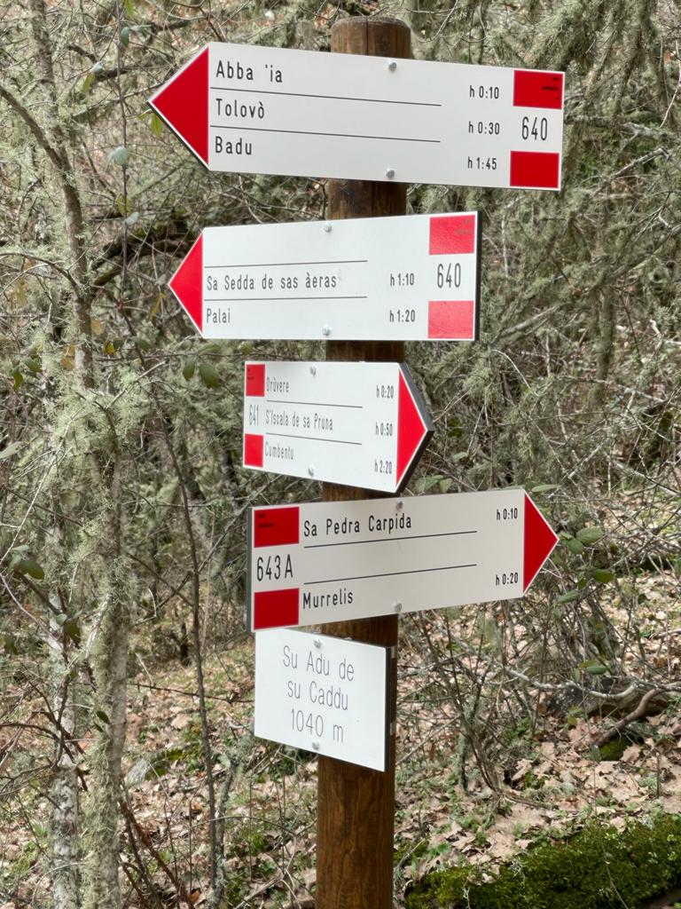
Su Adu 'e su Caddu (incrocio G-640, 641 e 643 A)
Nuoro,
Bolotana,
Marghine,
Area G,
Sardegna,
Europa
Su Adu 'e su Caddu (incrocio G-640, 641 e 643 A)
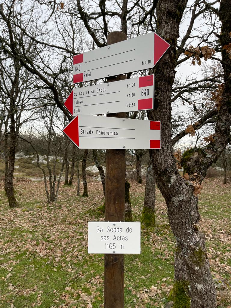
Sedda 'e sas Aeras (G 640)
Nuoro,
Area G,
Bolotana,
Marghine,
Sardegna,
Europa
Sedda 'e sas Aeras (G 640)
Murrelis - Inizio 643A, incrocio G 643
Nuoro,
Marghine,
Bolotana,
Area G,
Sardegna,
Europa,
Europa
Murrelis - Inizio 643A, incrocio G 643
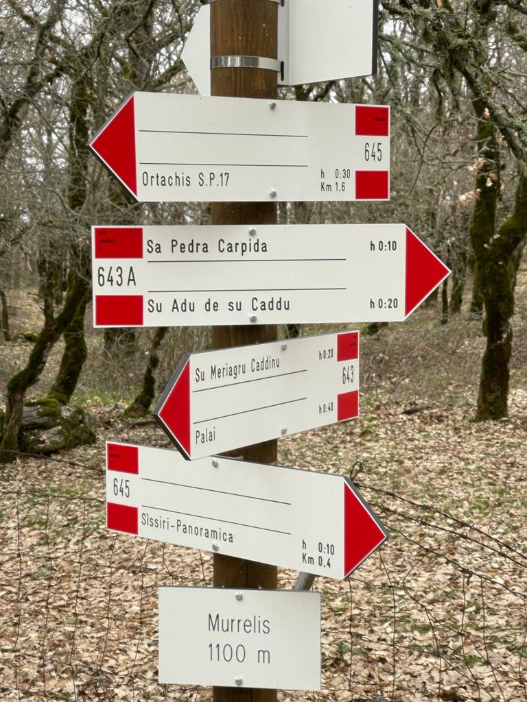
Sa Perda Carpida (G 643A)
Nuoro,
Marghine,
Bolotana,
Area G,
Sardegna,
Europa,
Europa
Sa Perda Carpida (G 643A)
Sissiri - Fine sentiero G 645
Europa,
Nuoro,
Marghine,
Bolotana,
Area G,
Sardegna,
Europa
Sissiri - Fine sentiero G 645