
Track details
Distance
32.5km
Duration
9h 00min
Ascent
1242m
Descent
847m
Starting altitude
261m
Arrival altitude
656m
Lowest point
135m
Highest point
813m
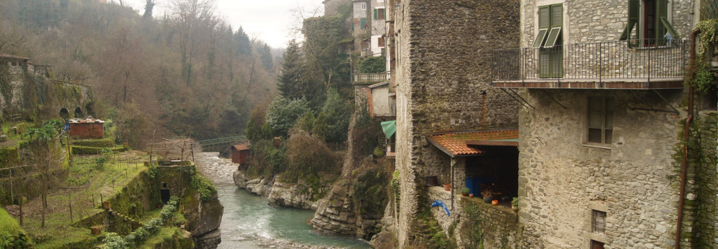
Bagnone
Its territory is essentially extending over mountains, on the Apennines side, being Monte Sillara (1891mt) the highest peak. The village sits on top of a rocky promontory, surrounded by oaks, chestnuts and pine forests.
Bagnone gained its importance thanks to its strategic importance, at the crossing of several roads merging to the valley from mountain passes
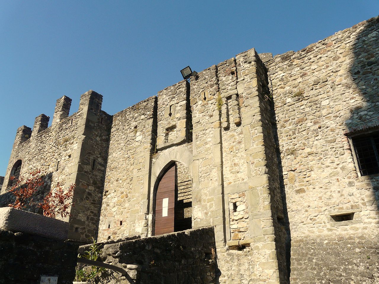
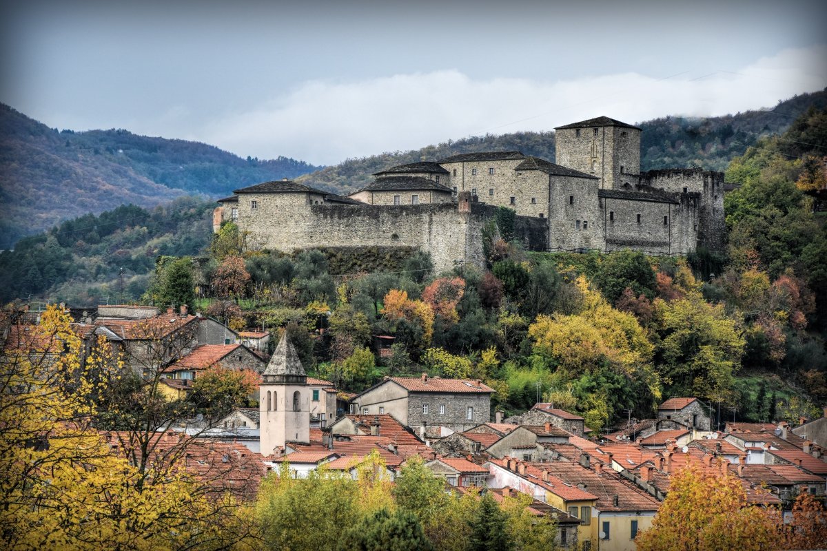
Malgrate castle
The fief of Niccolò I Malaspina included the walled lands of Malgrate and Filetto, the farmhouses of Cunale and Casola and the four villages of Orturano, Irola, Mocrone and Gragnana [1]. Among the Marquis’ children the district of Malgrate was entrusted to the four-born Bernabò Malaspina and it was at that time that the construction of the castle appeared as well as the development of the village [2]. The descendants of Bernabò held this dominion for two and a half centuries and alternated moments of quiet with turbulent events determined especially by the greed of the states of Florence and Milan for supremacy in Lunigiana.
These disputes made the survival of the political autonomy of the Bernabò dynasty difficult and provoked concerns, conflicts with subjects, disputes with neighboring feudal lords and invasions. The greatest tensions occurred in the fifteenth century: during the wars between the Duke of Milan Filippo Maria Visconti and the Republic of Florence, already allied with the Bernabò, the latter betrayed in favor of Milan the Florentine republic, which with the help of the population rebel in the marquisate occupied the castle for three years. With the peace of Ferrara in 1433 and after an act of submission to the republic, the Malaspina regained possession of their fiefdom. This fact provoked the resentment of Philip of Milan, so much so that in 1445 he had the castle attacked by his troops and destroy the fortifications.
In 1615 Cesare II, heavily indebted and without male children, sold the fiefdom to the Ducal Chamber of Milan which, after having kept it for twenty-six years and in need of money, sold it in 1641 to the noble Ariberti family of Cremona. The Cremonese family ruled with justice and liberality and following a revision of the structure led to the definitive transformation of the fortress from a war instrument into a bourgeois residence.
After the extinction of the Ariberti family, Malgrate passed in 1745 to the Freganeschi of Milan, joined to the Ariberti for part of the women, who retained their dominion until the time of the French Revolution. In the nineteenth century, dismantled and stripped of its possessions, the castle ruined almost entirely [2].
Today the castle of Malgrate, acquired from the state heritage, has been completely consolidated and restored thanks to the Structural Funds of the European Union and the funds of the Castelli della Lunigiana Special Project [3].
Architecture
The circular tower
The complex has the characteristics of a classic medieval fortress with a tower suitable for defense plumbing, central keep and curtain wall garnished with battlements and patrol walkways. The entrance to the castle is preceded by a moat and a bridge replaces an old drawbridge.
The trapezoidal walls are from the post-medieval period and are crossed in all their perimeter by walkways for the guards and buttresses with arches. The walls enclose the medieval core which has a rectangular planimetric shape.
The tower, probably dating back to the 12th century, is over twenty-five meters high and is located on the west side of the castle. Circular in shape and flanked by a fortified building with a rectangular plan, it has six overlapping vaulted rooms connected through hatches by retractable stairs, with the upper projection on stone corbels [4].
Next to the tower there are the remains of a central keep, residence of the feudal lord, probably on three floors and with an internal courtyard. The large slits suitable for the use of throwing weapons such as bows and crossbows date back to the 15th century. The access door to the village created by Giuseppe Malaspina in 1566 is welded to the eastern side of the castle walls.
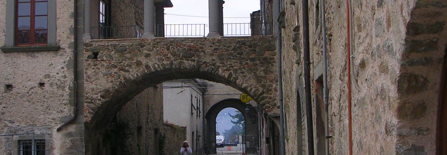
Filattiera
The name of the capital, deriving from the term Fulacterion, with which the Byzantines indicated the fortifications placed at the barrier of strategic points of great importance, clearly indicates its origin over time and its structural characteristics.
The village of Filattiera preserves the first settlement of the thirteenth century intact, with the Castrense church of San Giorgio and the watchtower and, perfectly legible, the development of the village of the following centuries with the Malaspinian castle, the church, the ancient hospital of San Giacomo.
Filattiera

The name of the capital, deriving from the term Fulacterion, with which the Byzantines indicated the fortifications placed at the barrier of strategic points of great importance, clearly indicates its origin over time and its structural characteristics.
The village of Filattiera preserves the first settlement of the thirteenth century intact, with the Castrense church of San Giorgio and the watchtower and, perfectly legible, the development of the village of the following centuries with the Malaspinian castle, the church, the ancient hospital of San Giacomo.
Filetto
Its origins are linked along VI-VII centuries to the struggle between Byzantines and Longubards: at that time a defensive line was organized on bizantines’ side in order to protect Luni harbourand prevent invasions from the Appenines side. Filetto was part of this defensive line
Filetto
Its origins are linked along VI-VII centuries to the struggle between Byzantines and Longubards: at that time a defensive line was organized on bizantines’ side in order to protect Luni harbourand prevent invasions from the Appenines side. Filetto was part of this defensive line
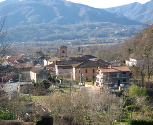
Mocrone
It was already mentioned in the year 1355 a.c as Mocoronum: its denomination comes from Latin “mucrone”, meaning “point” to describe the short plateau where it was settled.
Its alleys are narrow and winding, not allowing big cars to go through. At its entrance is a monument (sculptorist Riccardo Rossi) dedicated to Alberico Benedicenti (1866 Mondovi(CN) -1961 Mocrone), farmacologist and biologist known internationally. Around it also the noble palace Benedicenti.
Pontremoli
Pontremoli is believed to have been first settled around 1000 BC.[3] It was known in Roman times as Apua.[4] The commune later became an independent municipality in 1226 thanks to Frederick II who chartered the free municipality, partly because of its mountainous terrain. This terrain in the valley of the Magra also made Pontremoli a target for numerous conquests from rival Italian and foreign lords. Pontremoli was controlled by various aristocratic families, including the Malaspina (in 1319) and the Antelminelli (in 1322). The conflict between the rival Guelfi and Ghibellini factions in the early fourteenth century resulted in the construction of the Great Bell Tower (Il Campanone) to separate the rival camps. During these Medieval times Pontremoli was often visited by pilgrims travelling from Canterbury (England) to Rome.
In 1331 Pontremoli was sold by John I of Bohemia to Mastino II della Scala (Lord of Verona). Pontremoli was later taken over by the Visconti of Milan in 1339. In 1404 the ownership of Pontremoli once again changed hands as it was seized by the Fieschi family of Genoa. However, by 1433 Pontremoli was again under the control of the Milanese. In 1495 Pontremoli was sacked by the troops of Charles VIII of France. During this time Pontremoli was a territory owned by the House of Sforza, who were the new Dukes of Milan.
Pontremoli was a French territory from 1508 until 1522 as several northern Italian areas were conquered. In 1526, Pontremoli was captured by Charles V of the Holy Roman Empire. Pontremoli was controlled by Spain until 1647, when it was bought by the Republic of Genoa. Three years later, Pontremoli was made part of the (Medici) Grand Duchy of Tuscany. It stayed as such (with the exception of a period of French control from 1805 to 1814) until Italian unification in the nineteenth century.
With the Leopoldine reforms, Pontremoli became an autonomous community (whilst still part of the Grand Duchy of Tuscany) in 1777.[5] In 1778, it officially became a City.
The area was heavily damaged by an earthquake in 1834. In November 1847 Pontremoli was occupied (along with Fivizzano) by the Duke of Modena, due to a dispute over trade routes.
Giaredo Canyon
The Stretti di Giaredo have to be seen to be believed. This protected nature reserve stretches for two kilometres across the border of the Pontremoli and Zeri municipalities, walk in and out of the water as well as swimming through pristine pools hemmed in by naturally multicoloured rock faces.
Giaredo Canyon

The Stretti di Giaredo have to be seen to be believed. This protected nature reserve stretches for two kilometres across the border of the Pontremoli and Zeri municipalities, walk in and out of the water as well as swimming through pristine pools hemmed in by naturally multicoloured rock faces.