
Track details
Distance
50.8km
Duration
12h 45min
Ascent
1222m
Descent
1432m
Starting altitude
487m
Arrival altitude
276m
Lowest point
54m
Highest point
614m
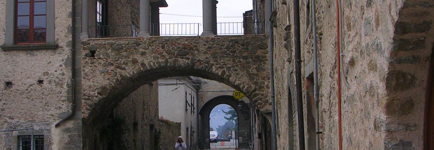
Piagnaro Castle
Pontremoli has been labeled “Porta dell’Appennino” (the door to the Apennines) for centuries, thanks to its highly strategic position at the junction of the Magra and Verde rivers. It overlooks Francigena street (also known as Monte Bardone street) and the large crowds of passersby, armies and pilgrims that it carried between the north and south of the peninsula.
The area developed along the narrow strip of land dividing the two rivers. A “pons tremulous” (wooden bridge) once crossed the Verde river, and is how the city got its name: Pontremoli. The birth of the settlement is obscure. Although the presence of Ligurian people in the area since early history seems certain, Pontremoli was referred to for the first time in 994 (as “Puntremel”) by Sigerico, Archbishop of Canterbury, in the description of his travels in Italy. The original center of village and castle rose up a few years before, in the middle of the 10th century, around a tower erected on Molinatico mountain’s meridional hill by the Longobarda deli Adalberti family in defense of Hungarian attack. The name Pignaro comes from a nearby slate slab quarry, the characteristic roof material of Lunigianian houses. (“Piagne” means “shingles”).
The advantage of Pontremoli’s strategic position was simultaneously the cause of war and destruction for the city and its castle. Due to the stratification of its walls from continual demolition and reconstruction, today, it’s difficult to clearly identify the fortification’s diverse phases of construction (from the year 1000 to the end of the 1700s) accounting for the structure’s complexity. To call out some of the principal damage: the first destruction took place in 1110 with the passing of Enrico V’s army; the most dramatic in 1495 with the invasion of Carlo VII; and the last during the WWII, during the retreat of the German army, with the allied bombing also responsible for the loss of many buildings in the historic center.
The ancient heart of Piagnaro is its highest point, which rose up around the fortified complex’s principal, 20-meter high, semioval stone tower. It is actually a four-sided figure linked to a semicircle with curved surfaces outside the city walls. The original entry was through a door in the internal facade, almost 10 meters from the ground, reachable by a wooden structure no longer in existence, and protected by a drawbridge of which traces have remained. Some elements suggest that the tower dates back to the 1430s.
Under the tower, a square courtyard defined on the west by a perimeter wall from the late middle ages, and on the south and east by a large building, the result of the unification of several diverse structures that were probably home to the castle’s barracks. The west side makes use of the preexisting perimeter wall and a supporting cylindrical tower.
A second courtyard lies below, with access by means of a ramp leading from a large door. The court, which houses a beautiful sandstone well, is defined on its southern and eastern sides by a perimeter with wallwalk. Its steep, sloping walls were built with a technique similar to that used to construct the tower. An addition on the eastern side includes a protruding defensive apparatus with angled gatekeeper’s room, and most likely dates back to the 18th century. There is a chapel on the northern side, while the western side is made up of an outstretched, two-floor building, home to the Museum of the Luingiana Stone Statues since 1975, and once the residence of the castle’s authorities.
The principal entrance, under a coat of Medicean arms, is down even further. It was once equipped with a drawbridge, reached by crossing the narrow village streets. The castle was “in arms” until 1790, the year that Grand Duke of Tuscany, Pietro Leopoldo, gave the community the last cannon from its battlements. The bronze was used to construct a new bell for the city tower.
In addition to the castle, Ponteremoli has an interesting medieval city center. The village was encircled in walls and well-defended by three fortresses (in addition to Piagnaro, there once were the Cacciaguerra and Castelnuovo Fortresses, of which ruins remain that were incorporated into the urban architectural structures to be touched on later) and six towers: two, in the upper part of the city, flanked Porta Parma; Seratti tower defended the bridge over the Verde river; and three were lined up along the eastern side of the lower part of the perimeter walls (since there was no running river to defend them, they were protected by a moat). Of the six ancient doors that opened into the walls of the city, only 4 remain: the upper, called San Giorgo (now known as Parma door); those defended by two, 14th century, humpbacked bridges, the Cresa and the Casotto (or Busticca), towards the Verde river; and the last, leading to the bridge over the Magra river.
One of the village’s particularities was its division into two distinct centers, one in the mountains and one in the valley, occupied by the Guelfs and the Ghibellines, respectively. In 1322, Castruccio Castracani built the Cacciaguerra Fortress in the autonomous space in the middle, in order to prevent the frequent conflicts between the inhabitants of the two zones. The fortress was endowed with three towers: the central one was converted into the municipal tower (called il Campanone); that on the East, on the Magra River, became the church bell tower; the other on the West, on the Verde river, was destroyed. Subsequently, Pontremoli expanded onto the left bank of the Magra river, where the Castelnuovo Fortress was erected, of which one tower and a door with pointed arch remain.
Piagnaro Castle

Pontremoli has been labeled “Porta dell’Appennino” (the door to the Apennines) for centuries, thanks to its highly strategic position at the junction of the Magra and Verde rivers. It overlooks Francigena street (also known as Monte Bardone street) and the large crowds of passersby, armies and pilgrims that it carried between the north and south of the peninsula.
The area developed along the narrow strip of land dividing the two rivers. A “pons tremulous” (wooden bridge) once crossed the Verde river, and is how the city got its name: Pontremoli. The birth of the settlement is obscure. Although the presence of Ligurian people in the area since early history seems certain, Pontremoli was referred to for the first time in 994 (as “Puntremel”) by Sigerico, Archbishop of Canterbury, in the description of his travels in Italy. The original center of village and castle rose up a few years before, in the middle of the 10th century, around a tower erected on Molinatico mountain’s meridional hill by the Longobarda deli Adalberti family in defense of Hungarian attack. The name Pignaro comes from a nearby slate slab quarry, the characteristic roof material of Lunigianian houses. (“Piagne” means “shingles”).
The advantage of Pontremoli’s strategic position was simultaneously the cause of war and destruction for the city and its castle. Due to the stratification of its walls from continual demolition and reconstruction, today, it’s difficult to clearly identify the fortification’s diverse phases of construction (from the year 1000 to the end of the 1700s) accounting for the structure’s complexity. To call out some of the principal damage: the first destruction took place in 1110 with the passing of Enrico V’s army; the most dramatic in 1495 with the invasion of Carlo VII; and the last during the WWII, during the retreat of the German army, with the allied bombing also responsible for the loss of many buildings in the historic center.
The ancient heart of Piagnaro is its highest point, which rose up around the fortified complex’s principal, 20-meter high, semioval stone tower. It is actually a four-sided figure linked to a semicircle with curved surfaces outside the city walls. The original entry was through a door in the internal facade, almost 10 meters from the ground, reachable by a wooden structure no longer in existence, and protected by a drawbridge of which traces have remained. Some elements suggest that the tower dates back to the 1430s.
Under the tower, a square courtyard defined on the west by a perimeter wall from the late middle ages, and on the south and east by a large building, the result of the unification of several diverse structures that were probably home to the castle’s barracks. The west side makes use of the preexisting perimeter wall and a supporting cylindrical tower.
A second courtyard lies below, with access by means of a ramp leading from a large door. The court, which houses a beautiful sandstone well, is defined on its southern and eastern sides by a perimeter with wallwalk. Its steep, sloping walls were built with a technique similar to that used to construct the tower. An addition on the eastern side includes a protruding defensive apparatus with angled gatekeeper’s room, and most likely dates back to the 18th century. There is a chapel on the northern side, while the western side is made up of an outstretched, two-floor building, home to the Museum of the Luingiana Stone Statues since 1975, and once the residence of the castle’s authorities.
The principal entrance, under a coat of Medicean arms, is down even further. It was once equipped with a drawbridge, reached by crossing the narrow village streets. The castle was “in arms” until 1790, the year that Grand Duke of Tuscany, Pietro Leopoldo, gave the community the last cannon from its battlements. The bronze was used to construct a new bell for the city tower.
In addition to the castle, Ponteremoli has an interesting medieval city center. The village was encircled in walls and well-defended by three fortresses (in addition to Piagnaro, there once were the Cacciaguerra and Castelnuovo Fortresses, of which ruins remain that were incorporated into the urban architectural structures to be touched on later) and six towers: two, in the upper part of the city, flanked Porta Parma; Seratti tower defended the bridge over the Verde river; and three were lined up along the eastern side of the lower part of the perimeter walls (since there was no running river to defend them, they were protected by a moat). Of the six ancient doors that opened into the walls of the city, only 4 remain: the upper, called San Giorgo (now known as Parma door); those defended by two, 14th century, humpbacked bridges, the Cresa and the Casotto (or Busticca), towards the Verde river; and the last, leading to the bridge over the Magra river.
One of the village’s particularities was its division into two distinct centers, one in the mountains and one in the valley, occupied by the Guelfs and the Ghibellines, respectively. In 1322, Castruccio Castracani built the Cacciaguerra Fortress in the autonomous space in the middle, in order to prevent the frequent conflicts between the inhabitants of the two zones. The fortress was endowed with three towers: the central one was converted into the municipal tower (called il Campanone); that on the East, on the Magra River, became the church bell tower; the other on the West, on the Verde river, was destroyed. Subsequently, Pontremoli expanded onto the left bank of the Magra river, where the Castelnuovo Fortress was erected, of which one tower and a door with pointed arch remain.
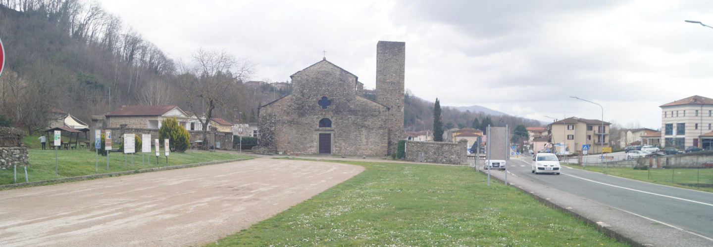
Filattiera
The name of the capital, deriving from the term Fulacterion, with which the Byzantines indicated the fortifications placed at the barrier of strategic points of great importance, clearly indicates its origin over time and its structural characteristics.
The village of Filattiera preserves the first settlement of the thirteenth century intact, with the Castrense church of San Giorgio and the watchtower and, perfectly legible, the development of the village of the following centuries with the Malaspinian castle, the church, the ancient hospital of San Giacomo.
Filattiera

The name of the capital, deriving from the term Fulacterion, with which the Byzantines indicated the fortifications placed at the barrier of strategic points of great importance, clearly indicates its origin over time and its structural characteristics.
The village of Filattiera preserves the first settlement of the thirteenth century intact, with the Castrense church of San Giorgio and the watchtower and, perfectly legible, the development of the village of the following centuries with the Malaspinian castle, the church, the ancient hospital of San Giacomo.
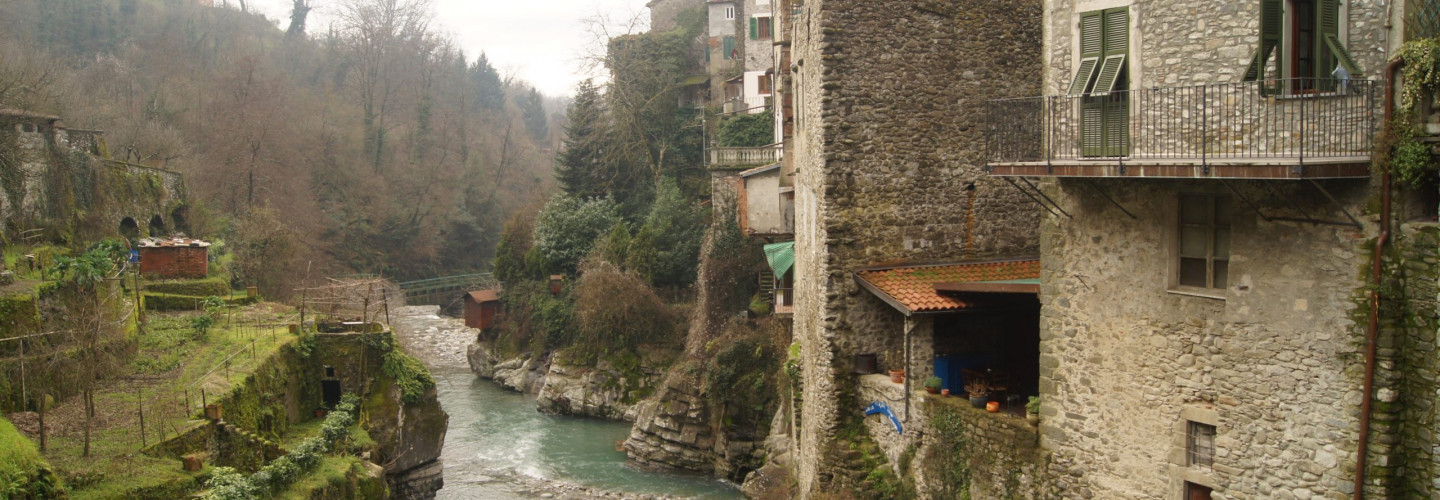
Filetto
Its origins are linked along VI-VII centuries to the struggle between Byzantines and Longubards: at that time a defensive line was organized on bizantines’ side in order to protect Luni harbourand prevent invasions from the Appenines side. Filetto was part of this defensive line
Filetto
Its origins are linked along VI-VII centuries to the struggle between Byzantines and Longubards: at that time a defensive line was organized on bizantines’ side in order to protect Luni harbourand prevent invasions from the Appenines side. Filetto was part of this defensive line
Bagnone
Its territory is essentially extending over mountains, on the Apennines side, being Monte Sillara (1891mt) the highest peak. The village sits on top of a rocky promontory, surrounded by oaks, chestnuts and pine forests.
Bagnone gained its importance thanks to its strategic importance, at the crossing of several roads merging to the valley from mountain passes
Villafranca Lunigiana
Its origin is around XII century thanks to the increasing importance of the “monte Bardone way” else “Via Francigena”
[From www.terredilunigiana.com ]
Villafranca Lunigiana
Its origin is around XII century thanks to the increasing importance of the “monte Bardone way” else “Via Francigena”
[From www.terredilunigiana.com ]
Virgoletta
In the basement of the actual tower nowadays few elements of longubard origins are present, so a prior origin is not to be excluded.
First lords of Virgoletta were Corbellari family, who were operating on behalf of Bishop of Luni and Obertenghi Marquees. Since 1221 Malaspina family will take over and divide Lunigiana into 2 areas: “Bloomed Thorn” and “Dry Thorn”. Virgoletta will be included in the second.
Its castle is mentioned right on these kind of documents (1275). Malaspina family will erect new walls 11mts high on the south of the castle and build a cistern inside the castle. In this historical moment the first houses are build on two wings along the road leading to the castle, so that the access of the castle is moved towards them.
In 1449 Galeotto Campofregoso conquers the castle and maintain it until 1471, transforming it in a residencial palace, even thou fortifying the walls outside. Then Malaspina will take over again, until 1705 when a riot of inhabitants of Virgoletta against Giovanni Malaspina aimed to aid Filippo the 5Th of Spain and french-sanish invasion. Granduke of Tuscany was able to defend against the invasion and return Virgoletta to Malaspina family: as a consequence all the rebels were sent off the castle for at least 8miles; this gives the actual shapes of the settlement. At the moment the castle is private and is slowly going through cycles of abandoning and refurbishing
Virgoletta

In the basement of the actual tower nowadays few elements of longubard origins are present, so a prior origin is not to be excluded.
First lords of Virgoletta were Corbellari family, who were operating on behalf of Bishop of Luni and Obertenghi Marquees. Since 1221 Malaspina family will take over and divide Lunigiana into 2 areas: “Bloomed Thorn” and “Dry Thorn”. Virgoletta will be included in the second.
Its castle is mentioned right on these kind of documents (1275). Malaspina family will erect new walls 11mts high on the south of the castle and build a cistern inside the castle. In this historical moment the first houses are build on two wings along the road leading to the castle, so that the access of the castle is moved towards them.
In 1449 Galeotto Campofregoso conquers the castle and maintain it until 1471, transforming it in a residencial palace, even thou fortifying the walls outside. Then Malaspina will take over again, until 1705 when a riot of inhabitants of Virgoletta against Giovanni Malaspina aimed to aid Filippo the 5Th of Spain and french-sanish invasion. Granduke of Tuscany was able to defend against the invasion and return Virgoletta to Malaspina family: as a consequence all the rebels were sent off the castle for at least 8miles; this gives the actual shapes of the settlement. At the moment the castle is private and is slowly going through cycles of abandoning and refurbishing
Pieve di Sorano
The parish church of Santo Stefano di Sorano in Filattiera is one of the most important Romanesque parishes in the province of Massa Carrara. It rises in a strategic area, frequented since prehistoric times (seven stele statues have been found in the area) and still preserves the plant of the XII century, a Romanesque architectural masterpiece, with an imposing apsidal system entirely made of rough-hewn sandstone pebbles. Inside the entirely restored parish church, numerous medieval elements are preserved as well as two original stele statues (Sorano I and Sorano V).
The area where the church stands is frequented since prehistoric times, as evidenced by the 7 stele statues found in the surrounding area and the numerous finds from the Iron Age. After the Roman phase, testified by the presence of a “mansio” recently investigated archaeologically, Filattiera was an important Byzantine military settlement. Before the current parish church there must have been another early medieval church (VIII-IX century) from which the Epigraph of Leodegar (752 AD) today in the church of San Giorgio inside the village.
The Romanesque parish church was built between the 11th and 12th centuries as part of the ecclesiasitic reorganization of the Diocese of Luni, of which this church is perhaps the most important dependence in Lunigiana. The Pieve di S. Stefano di Sorano has been mentioned since the 11th century in all the main documents related to the Diocese of Luni and experiences its heyday until the 14th century, when it begins to be abandoned and is gradually transformed into a cemetery chapel .
The current appearance is the result of a large restoration completed in 2000, which has restored the original appearance. The whole building is made with a very particular technique, with river pebbles not squared and put in place with abundant mortar.
The plan is a basilica with three naves, without a transept, with the central nave larger than the other two and the slightly raised presbytery. On the facade you can see the polylobed rose window and some buffered openings in the masonry. In the left internal counter-facade, in the corner, the stele statues Sorano I and Sorano V, found in the area of the church: Sorano V was reused as an architrave of a small entrance open on the facade and then buffered.
The interior is sober, severe, not very bright, with large double-ring arches resting on round pillars with very short engraved capitals. On the left side there are some eighteenth-century masonry arches inserted between the Romanesque ones.
The decoration and symbols are reduced to a minimum, however there are some interesting images, in particular the monstrous figure present in the upper part of the central nave, on the left side.
The most interesting architectural part of the church from the point are certainly the three apses, built with an architectural decoration on different levels of depth. In the upper part of the main apse you can see traces of some small figured half-capitals.
The bell tower, perhaps born as a defensive structure, is connected to the church but represents an element in its own right.
A few meters from the parish church, heading north, there is the Sorano Didactic Center, home to an area equipped for excavation exercises, didactic archeology lessons, conferences and conventions.
[Source: turismoinlunigiana.it]Pieve di Sorano
The parish church of Santo Stefano di Sorano in Filattiera is one of the most important Romanesque parishes in the province of Massa Carrara. It rises in a strategic area, frequented since prehistoric times (seven stele statues have been found in the area) and still preserves the plant of the XII century, a Romanesque architectural masterpiece, with an imposing apsidal system entirely made of rough-hewn sandstone pebbles. Inside the entirely restored parish church, numerous medieval elements are preserved as well as two original stele statues (Sorano I and Sorano V).
The area where the church stands is frequented since prehistoric times, as evidenced by the 7 stele statues found in the surrounding area and the numerous finds from the Iron Age. After the Roman phase, testified by the presence of a “mansio” recently investigated archaeologically, Filattiera was an important Byzantine military settlement. Before the current parish church there must have been another early medieval church (VIII-IX century) from which the Epigraph of Leodegar (752 AD) today in the church of San Giorgio inside the village.
The Romanesque parish church was built between the 11th and 12th centuries as part of the ecclesiasitic reorganization of the Diocese of Luni, of which this church is perhaps the most important dependence in Lunigiana. The Pieve di S. Stefano di Sorano has been mentioned since the 11th century in all the main documents related to the Diocese of Luni and experiences its heyday until the 14th century, when it begins to be abandoned and is gradually transformed into a cemetery chapel .
The current appearance is the result of a large restoration completed in 2000, which has restored the original appearance. The whole building is made with a very particular technique, with river pebbles not squared and put in place with abundant mortar.
The plan is a basilica with three naves, without a transept, with the central nave larger than the other two and the slightly raised presbytery. On the facade you can see the polylobed rose window and some buffered openings in the masonry. In the left internal counter-facade, in the corner, the stele statues Sorano I and Sorano V, found in the area of the church: Sorano V was reused as an architrave of a small entrance open on the facade and then buffered.
The interior is sober, severe, not very bright, with large double-ring arches resting on round pillars with very short engraved capitals. On the left side there are some eighteenth-century masonry arches inserted between the Romanesque ones.
The decoration and symbols are reduced to a minimum, however there are some interesting images, in particular the monstrous figure present in the upper part of the central nave, on the left side.
The most interesting architectural part of the church from the point are certainly the three apses, built with an architectural decoration on different levels of depth. In the upper part of the main apse you can see traces of some small figured half-capitals.
The bell tower, perhaps born as a defensive structure, is connected to the church but represents an element in its own right.
A few meters from the parish church, heading north, there is the Sorano Didactic Center, home to an area equipped for excavation exercises, didactic archeology lessons, conferences and conventions.
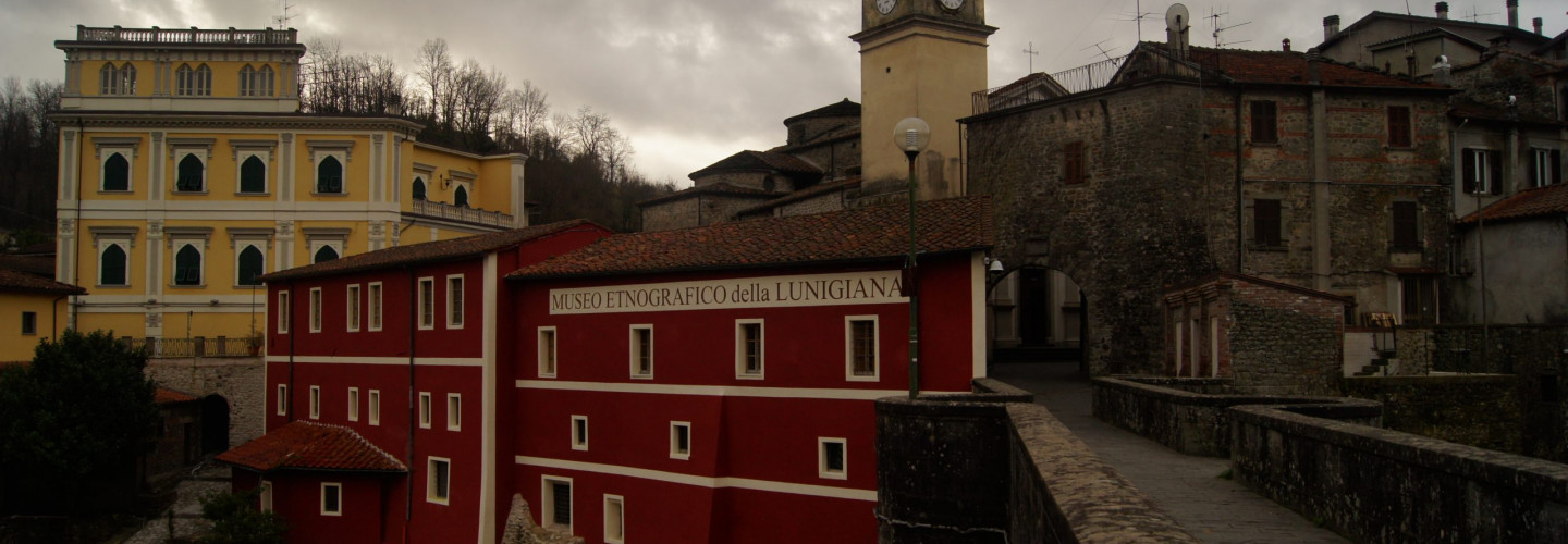
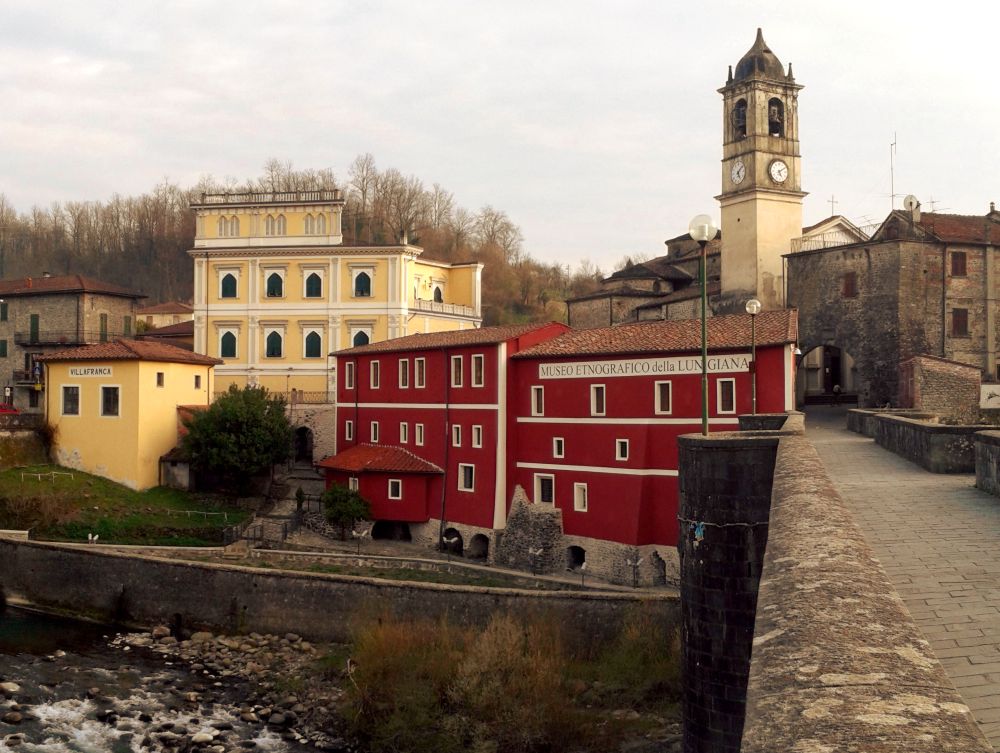
[Source: turismoinlunigiana.it]Ethnografic museum Villafranca Lunigiana
The society, culture, customs, beliefs, traditions of the people of Lunigiana are gathered here, jealously preserved and available to be observed, studied, or simply admired by visitors who want to discover the secrets of a unique territory in its generally in Italy
Ethnografic museum Villafranca Lunigiana
The society, culture, customs, beliefs, traditions of the people of Lunigiana are gathered here, jealously preserved and available to be observed, studied, or simply admired by visitors who want to discover the secrets of a unique territory in its generally in Italy