
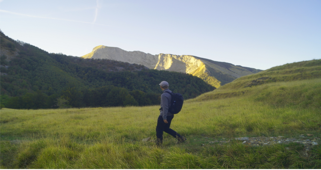
Track details
Distance
8.4km
Duration
3h 15min
Ascent
715m
Descent
717m
Starting altitude
1235m
Arrival altitude
1232m
Lowest point
932m
Highest point
1438m
Passo Croce/Fociomboli
Leave your car here to access routes of the area
Passo Croce/Fociomboli
Leave your car here to access routes of the area
Fociomboli swamp
Fociomboli is a marshy meadow basin, located between 1120 and 1150 meters above sea level, which extends for about one hectare above the mountain pasture of Puntato and at the foot of the northern slope of Mount Corchia and the eastern slope of Mount Freddone.
It is surrounded by a beech forest and is crossed by streams of meteoric water that descend from the limestone rocks of the surrounding mountains. In addition, the basin is also fed by underground springs that gush at the points of contact between the limestone and impermeable rocks.
The marsh is the remnant of a small lake of glacial origin that has been maintained thanks to the impermeable bottom, mainly formed by schist dolomite, which forms its bed in contrast with the karst rock of the surrounding areas.
In this way the waters are forced to emerge and on the northern edge a small emissary is formed which forms the Canale delle Fredde, emissary of the Tùrrite Secca which, in turn, then flows into the Serchio in Castelnuovo Garfagnana.
This peat bog is the only humid environment at high altitude in the Apuan Alps in contrast with the numerous lakes and marshes in the nearby Apennines and consequently it is of considerable environmental interest. The marsh is, in fact, rich in rare botanical species mostly neutrophilic or slightly basophilic since the calcareous waters that feed the peat bog neutralize its acidity. In addition, the peat deposits conserve fossil pollens which document which botanical species lived here in the glacial and post-glacial period.
The visit to the Padule is an easy excursion and is recommended for botany lovers. The exceptional nature of the biotope would probably require greater protection by the Apuan Alps Park.
Who does not know its existence has no information on how to reach it: perhaps it is better this way because it avoids the damage that some intentioned evil could cause it, but the suspicion remains that the real importance of the Padule is underestimated by the administrators.
The ecological changes in the area involve the risk of loss of rare species. The dangers are related to grazing, mostly horses, and to frequenting by tourists, even if respectful of the environment.
Puntato pasture
Located between 1000 and 1100 meters above sea level in a place where paths 11 from Fociomboli and 128 from Tre Fiumi to the Rifugio Del Freo converge, this basin is surrounded by the Corchia, Freddone Pania della Croce and Pizzo delle Saette mountains, which from here it appears in its most imposing guise.
In past centuries, and up to the 80s, it was used by the shepherds of the Terrinca community, as evidenced by the old farmhouses and ruins of the area and also a church that stands in the center of the mountain pasture. Some farmhouses have been renovated and used for the reception of hikers and day trippers with beds and kitchen: the “Il Robbio” hut which is a small farm, the “Ciampi” hut and the “La Quiete” refuge.
The church of Puntato is dedicated to the SS. Trinity and dates back to 1679, nearby there was an older majesty built for his devotion by Francesco Bacchelli with a marble icon dedicated to the Madonna of the Rosary with the Child and St. John the Baptist. After the dismantling of the majesty, the icon was walled up on the church wall and subsequently stolen in 1973.
The wild man Spelunk
The entrance is at 1150 meters, the depth is 281 meters and the spatial development around 1400.
The cave was known by the valleys from time immemorial and they had created frightening legends on it.
The first descent, a few tens of meters, dates back to 1912, a subsequent one in 1923 went further, but only in the period 1929-1930 did an expedition of the GSF travel the entire cave.
The entrance is an imposing sinkhole in which a small stream of water that descends from Corchia is lost, the cave consists of a series of galleries and wells.
The name derives from a very widespread figure in local folklore and in general all over the world.
Hairy, monstrous, wild and cave dweller, homo selvaticus is a myth born with humanity: it is the ancestral past that cannot be forgotten.
One looks at it on one side with nostalgia for what has been lost and on the other with contempt and a sense of superiority for the civilization that we think we have acquired.
So he looks at it with a mixture of fear and admiration and he himself acquires both positive and negative values in the collective imagination.
Local legends say that he taught shepherds how to use milk to make cheese and ricotta, but then annoyed by their further requests he returned to his caves.
However, other versions consider him as a dangerous being who wanders through the forests from which he comes out to kidnap girls and is dedicated to bloody and pagan rites.
Panorama point onto Versilia
It can be reached effortlessly from Rifugio Del Freo in about 10 minutes, walking towards the attack on the ridge of Monte Corchia, in Punta Pepora
Panorama point onto Versilia
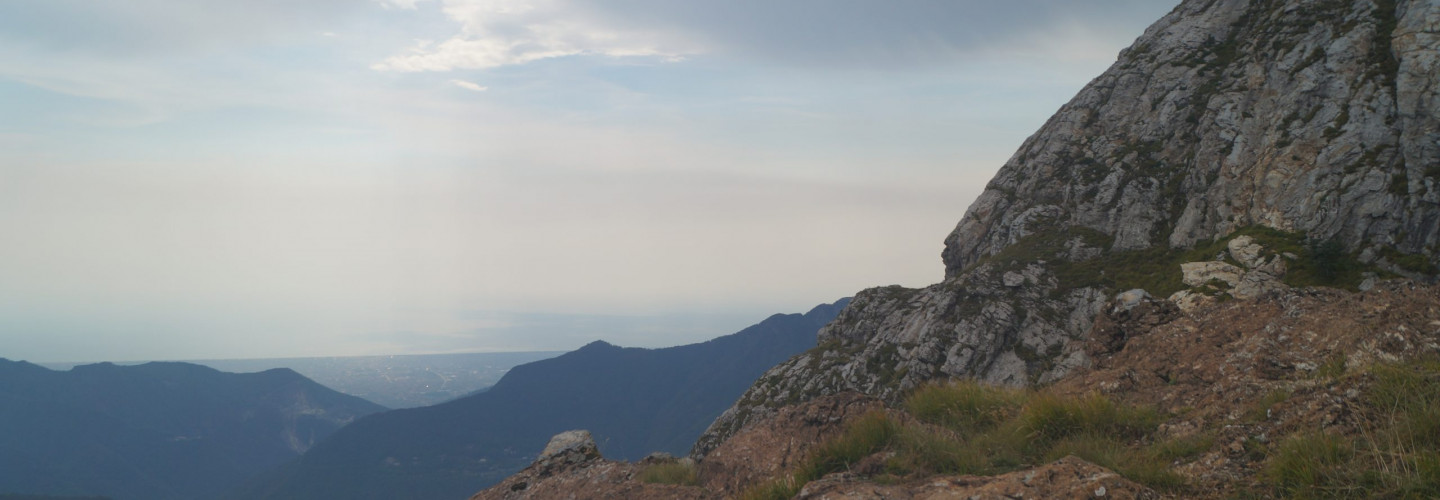
It can be reached effortlessly from Rifugio Del Freo in about 10 minutes, walking towards the attack on the ridge of Monte Corchia, in Punta Pepora
Rifugio Del Freo
Pertaining to the Viareggio Section of the CAI, it is located in an open valley characterized by numerous water springs, meadows, beech and coniferous forests.
Ancient peat bog and communication route between Versilia and Garfagnana, at the foot of the Pania della Croce; the area was once used as a mountain pasture in the towns of Levigliani and Pruno.
The area is characterized by karst caves of considerable speleological interest such as the Antro del Corchia and the Tana dell’Omo Selvatico, a legendary place a few minutes from the refuge.
Rifugio Del Freo
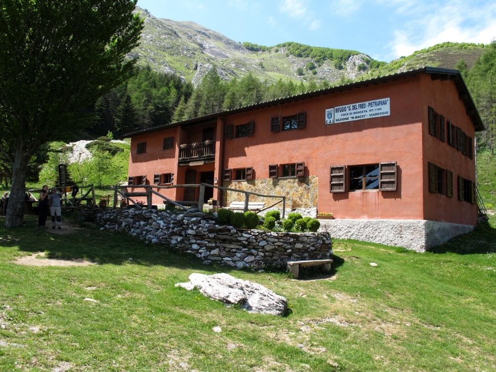
Pertaining to the Viareggio Section of the CAI, it is located in an open valley characterized by numerous water springs, meadows, beech and coniferous forests.
Ancient peat bog and communication route between Versilia and Garfagnana, at the foot of the Pania della Croce; the area was once used as a mountain pasture in the towns of Levigliani and Pruno.
The area is characterized by karst caves of considerable speleological interest such as the Antro del Corchia and the Tana dell’Omo Selvatico, a legendary place a few minutes from the refuge.
+39 333 734 3419
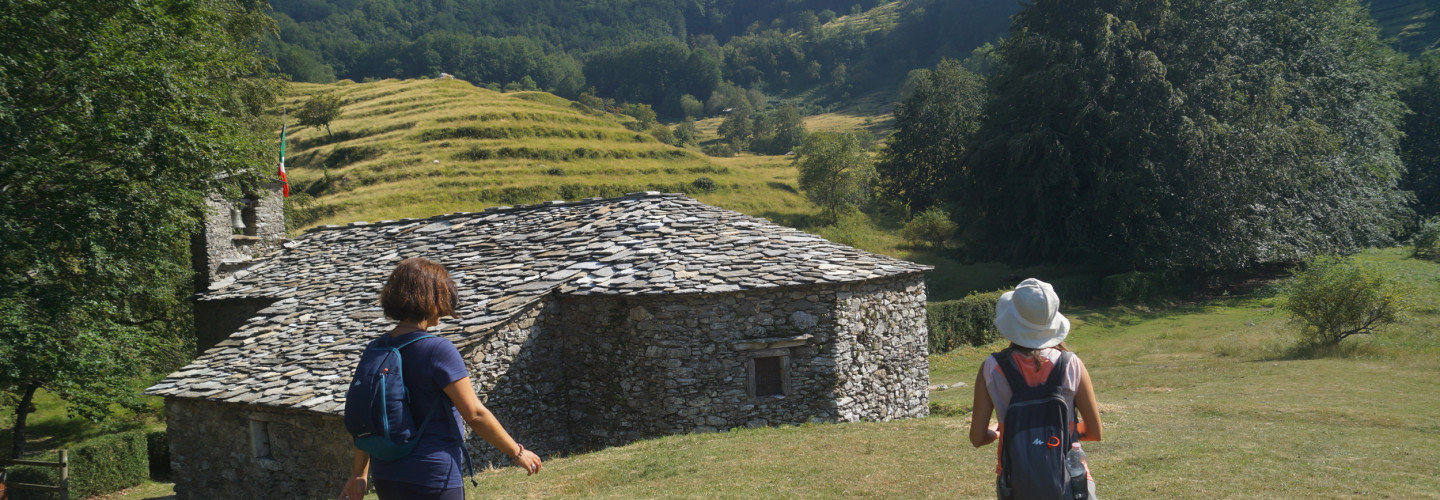
Oratory of S. Trinità al Puntato
Each village in the upper Versilia has at least one Alpe, where the inhabitants with their families and their herds moved from spring to autumn to cultivate it. Terrinca has several among which one stands out both for the vastness of the “Logos”, the woods, the meadows and the significant number; of the huts, both for the presence of the church, the fulcrum of religiosity and the real center of the village.
Notwithstanding the principle that required the construction of houses on land marginal to agriculture, the Oratory was built in the flat and more fertile area, removing it from crops, at the intersection of the main mule tracks, almost in a central position on the mountain pasture.
Already before 1657, at the crossroads formed by the road to Puntato, by the local road of the Carpini hills, by the via di val terra that leads to the Holy Island, by the road of the Barca that leads to col di Favilla, it had been raised, out of devotion , a shrine by Francesco Bacchelli, whose marble bas-relief depicted the Madonna del Rosario, the Child and St. John the Baptist. The aedicule, still visible in the 1810 terrilogio, was demolished in the twentieth century and his Madonna, which remained walled up on the facade of the church sacristy up to the present day, after 1973, like many others, was stolen.
Precisely at this point, as the squat plaque inserted above the central door recalls, the oratory of the S.S. Trinity in 1679