webmapp map

Track details

Distance

29km

Duration

6h 45min

Ascent

389m

Descent

261m

Starting altitude

15m

Arrival altitude

143m

Lowest point

13m

Highest point

152m

Altopascio credential stamp point

Ring the bell. Alternatively, hear the Altopascio Library 100m from this point inside the Piazza Ospitalieri just crossed

Info point Via Francigena San Miniato

Even some affiliated facilities in the area may have the stamp available

Ponte a Cappiano

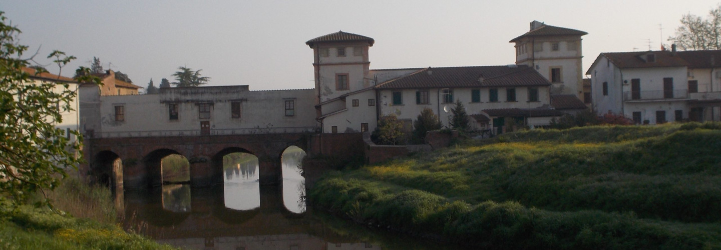
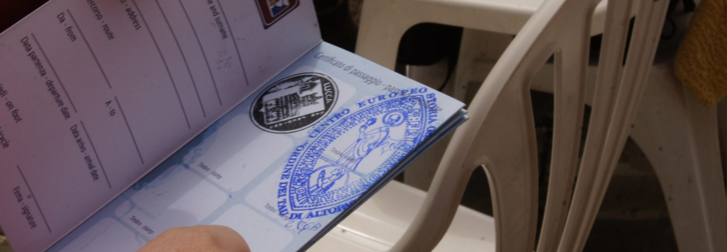
The area has been frequented since ancient times, as evidenced by the discovery (in 1912) of two copper ingots dating back to the pre-Roman era in the locality of Tricolle, located along the Usciana canal about 1 km north-east of the current city ​​centre. In the same Tricolle locality an armilla and a component of equine harnesses from the Roman era were later found (in 1924). The existence of the bridge, on the other hand, is documented from the early Middle Ages: it was managed by the Altopascio Hospitallers and the ancient Via Francigena passed over it. In particular, in the itinerary of Sigeric, Archbishop of Canterbury, it represented the 24th stage (Submansio) and the locality was then defined Aqua Nigra, most likely due to the dark water of the Usciana canal, then called Gusciana, emissary of the Fucecchio Marsh . The locality was subsequently mentioned with the name of Cappianus de Ultra Ponte and then Pons ad Cappianum in reference to the homonymous parish. In 1325, during the conflict between Florence and Lucca, the bridge was destroyed. Later it was rebuilt and then fortified with a tower and equipped with drawbridges [3]. The structure was equipped with a lock to regulate the flow of water but also favored the fishing of eels. There was also a mill and a water saw for cutting wood. The Cappiano Bridge was also studied by Leonardo da Vinci. In sheet RLW 12685, the great artist and scientist depicts the bridge highlighting its defensive structure and, in particular, the tower. The current form was built in the first half of the sixteenth century by Cosimo I de ‘Medici. In that period, the open bridge and the covered bridge were built. The annexed buildings were added: the inn, the ironworks and the house of the administrator who presided over the administration of the farm. Two tombstones can still be seen today, one in Latin and one in Italian, which testify to these facts.

Fucecchio

. The communal age was a period of intense growth in which Fucecchio had strategic importance as a frontier territory in the disputes between Lucca and Florence, saw the exploits and sometimes decided the fate of Castruccio Castracani. On 14 December 1330, following its own request, the municipality of Fucecchio entered under the power of the Florentine Republic and from that date it followed its fate and wishes, accepting among other things also the Podestà who would be designated by the Signoria. Around the middle of the 1300s, population growth was slowed down by a serious plague and the population was decimated. The recovery was slow and coincided with the repopulation of the countryside starting from 1500, becoming even faster from the second half of the 1700s. Thus, in 1800, Fucecchio was again a populous town with the main activities related to manufacturing, crafts and to small businesses; but it will be after the Second World War that it will meet its true “industrial revolution” thanks to the development of the tanning and footwear sectors. In the nineteenth century the community followed and participated in the historical events of the Risorgimento expressing itself with one of the most important figures of the time, Giuseppe Montanelli. On 23 August 1944 the hamlets of Querce and Massarella were among the places hit by the massacre of the Padule di Fucecchio in which the 26th armored division of the German Nazi army killed a total of 175 civilians (of which only one partisan). Fucecchio was liberated on 1 September 1944 by the 6th South African Armored Division and the 1st American Armored Division.